


Lackawanna County--Scranton City, Dunmore, Old Forge, Taylor & Moosic Boroughs PUMA, Pennsylvania
About
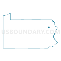
Outline

Summary
| Unique Area Identifier | 193844 |
| Name | Lackawanna County--Scranton City, Dunmore, Old Forge, Taylor & Moosic Boroughs PUMA |
| State | Pennsylvania |
| Area (square miles) | 49.67 |
| Land Area (square miles) | 49.32 |
| Water Area (square miles) | 0.35 |
| % of Land Area | 99.29 |
| % of Water Area | 0.71 |
| Latitude of the Internal Point | 41.39733100 |
| Longtitude of the Internal Point | -75.67015870 |
Maps
Lackawanna County--Scranton City, Dunmore, Old Forge, Taylor & Moosic Boroughs PUMA in Pennsylvania
Download

Graphs
Select a template below for downloading or customizing gragh for Lackawanna County--Scranton City, Dunmore, Old Forge, Taylor & Moosic Boroughs PUMA, Pennsylvania


Neighbors
Neighoring Public Use Microdata Area (by Name) Neighboring Public Use Microdata Area on the Map
- Lackawanna (Outside Greater Scranton City) & Wyoming Counties PUMA, PA
- Luzerne County (East)--Kingston Borough PUMA, PA
Top 10 Neighboring County (by Population) Neighboring County on the Map
Top 10 Neighboring County Subdivision (by Population) Neighboring County Subdivision on the Map
- Scranton city, Lackawanna County, PA (76,089)
- Dunmore borough, Lackawanna County, PA (14,057)
- South Abington township, Lackawanna County, PA (9,073)
- Old Forge borough, Lackawanna County, PA (8,313)
- Taylor borough, Lackawanna County, PA (6,263)
- Dickson City borough, Lackawanna County, PA (6,070)
- Moosic borough, Lackawanna County, PA (5,719)
- Duryea borough, Luzerne County, PA (4,917)
- Throop borough, Lackawanna County, PA (4,088)
- Pittston township, Luzerne County, PA (3,368)
Top 10 Neighboring Place (by Population) Neighboring Place on the Map
- Scranton city, PA (76,089)
- Dunmore borough, PA (14,057)
- Old Forge borough, PA (8,313)
- Taylor borough, PA (6,263)
- Dickson City borough, PA (6,070)
- Moosic borough, PA (5,719)
- Duryea borough, PA (4,917)
- Throop borough, PA (4,088)
- Avoca borough, PA (2,661)
- Chinchilla CDP, PA (2,098)
Top 10 Neighboring Unified School District (by Population) Neighboring Unified School District on the Map
- Scranton School District, PA (76,089)
- Pittston Area School District, PA (27,837)
- Abington Heights School District, PA (23,623)
- North Pocono School District, PA (20,809)
- Mid Valley School District, PA (15,309)
- Dunmore School District, PA (14,057)
- Riverside School District, PA (11,982)
- Old Forge School District, PA (8,313)
Top 10 Neighboring State Legislative District Lower Chamber (by Population) Neighboring State Legislative District Lower Chamber on the Map
- State House District 118, PA (67,168)
- State House District 115, PA (63,002)
- State House District 112, PA (61,228)
- State House District 113, PA (58,803)
- State House District 114, PA (58,068)
Top 10 Neighboring State Legislative District Upper Chamber (by Population) Neighboring State Legislative District Upper Chamber on the Map
Top 10 Neighboring 111th Congressional District (by Population) Neighboring 111th Congressional District on the Map
Top 10 Neighboring Census Tract (by Population) Neighboring Census Tract on the Map
- Census Tract 1118, Lackawanna County, PA (8,558)
- Census Tract 1104.01, Lackawanna County, PA (6,685)
- Census Tract 1125, Lackawanna County, PA (6,263)
- Census Tract 1128, Lackawanna County, PA (5,719)
- Census Tract 1126, Lackawanna County, PA (5,463)
- Census Tract 2105, Luzerne County, PA (4,917)
- Census Tract 1018, Lackawanna County, PA (4,789)
- Census Tract 1120, Lackawanna County, PA (4,563)
- Census Tract 1003, Lackawanna County, PA (4,453)
- Census Tract 1124, Lackawanna County, PA (4,266)
Top 10 Neighboring 5-Digit ZIP Code Tabulation Area (by Population) Neighboring 5-Digit ZIP Code Tabulation Area on the Map
- 18411, PA (21,985)
- 18504, PA (21,265)
- 18505, PA (20,586)
- 18640, PA (17,155)
- 18510, PA (14,119)
- 18444, PA (13,778)
- 18509, PA (13,589)
- 18508, PA (12,292)
- 18512, PA (12,218)
- 18518, PA (8,313)